


col de la Madeleine

verozerr
User
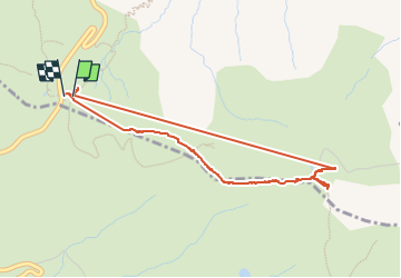

Length
4.2 km

Max alt
2180 m

Uphill gradient
210 m
Km-Effort
7 km

Min alt
1985 m

Downhill gradient
206 m
Boucle
Yes
Creation date :
2024-07-08 09:07:12.952
Updated on :
2024-09-20 14:54:31.423
4h02
Difficulty : Medium

FREE GPS app for hiking
 SityTrail
IGN / Geographical institutes
SityTrail Plus
The world is yours!
About
Trail Walking of 4.2 km to be discovered at Auvergne-Rhône-Alpes, Savoy, La Léchère. This trail is proposed by verozerr.
Description
piste vers Valmorel
Positioning
Country:
France
Region :
Auvergne-Rhône-Alpes
Department/Province :
Savoy
Municipality :
La Léchère
Location:
Celliers
Start:(Dec)
Start:(UTM)
294808 ; 5034667 (32T) N.
Comments